Wayne’s · Based in Wrens, Georgia
Excavation.
Grading & site work.
Digging, grading, and moving soil for site preparation and access improvements. Ground conditions, drainage, and equipment access determine the scope of work.
Plan your excavation project ↗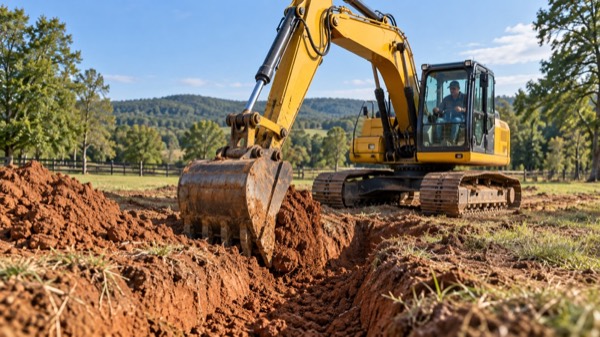
Understand the work
Excavation & grading work.
Excavation and grading involve digging, moving soil, and shaping ground for site preparation and property improvements. Work may include access routes, grade changes, and preparation of a work area.
Clearing removes vegetation; excavation changes the ground itself. Soil conditions, elevations, drainage, equipment access, and disposal or reuse of material must be reviewed before the work is confirmed.
Common project goals
- Site and property preparation
- Driveway or equipment-access improvements
- Grading and ground shaping
- Digging and related property work
Site conditions
What affects the scope?
An estimate considers the work required and the conditions on site.
- 01Soil, terrain, grade changes, and existing conditions
- 02The amount and destination of material to be moved
- 03Equipment access and the space available to work
- 04The intended use, finish, and drainage considerations
Before requesting an estimate
Details to have ready.
Explain what the finished site needs to do. Include the location, access, any plans already available, known features or obstacles, and your timeline. A map can illustrate the work area, but it is not a surveyed boundary or engineering plan.
Wayne’s is based in Wrens, Georgia. Land projects in Georgia and South Carolina are considered by location, access, project size, and scheduling. Free quote visits are available within the CSRA; travel or onsite estimate fees may apply elsewhere and should be confirmed before a visit.
Explore the landowner’s guide ↗Questions about excavation
Common questions.
01Can I combine excavation with land clearing?
Yes, when the job requires both. Explain what needs to be cleared and how the ground will be used so the work can be estimated together.
02Can the map provide a final estimate?
No. Map measurements are approximate planning aids. Conditions on the property and the agreed scope determine the final estimate.
03What should I explain about an access project?
Describe the vehicles or equipment that need access, the existing route, gates or tight spaces, and the final surface or use you have in mind. The appropriate approach needs a site-specific discussion.
Project details
Plan the work.
Save the details.
Record the property location, work needed, and preferred timeline. You can also mark up to three work areas on the optional map.
For now, build and download a project brief for your records. Nothing is sent to Wayne.
Keep any property photos with your project notes. This website does not currently accept uploads.
Not sure which service fits? Explore the guide ↗